Unable to return, displaced southern Lebanese turn to satellite images to check on homes
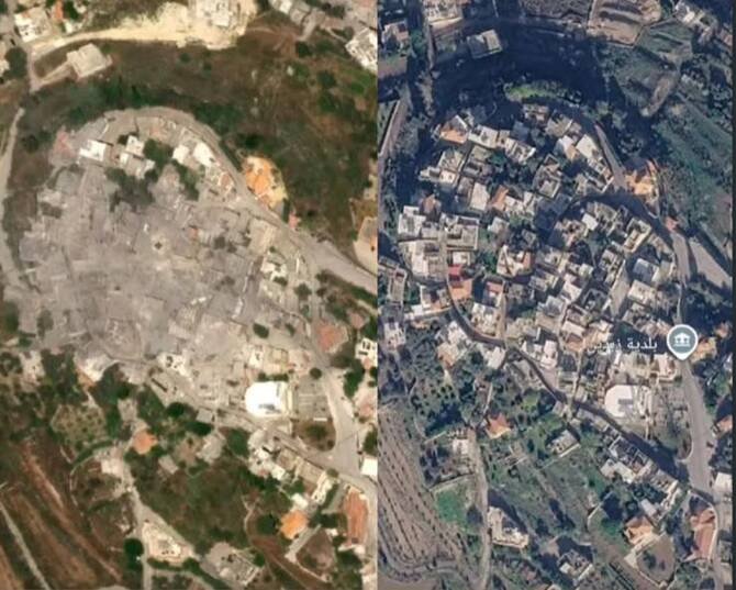
BEIRUT(RAHNUMA): Displaced residents of villages in southern Lebanon, who currently have no way of reaching their homes, are turning to commercial satellite imagery to learn whether the houses they fled are still standing. For many families, the images offer the first glimpse of homes left behind during successive waves of displacement since Israel’s war on […]
Israel operating beyond ceasefire line in Gaza, satellite images suggest
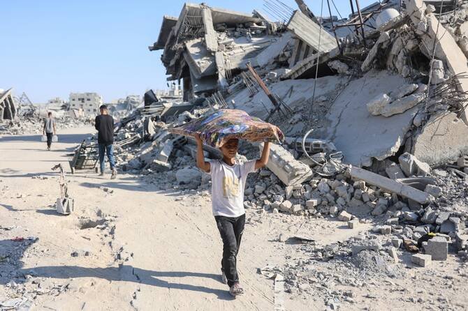
LONDON(RAHNUMA): Israel has moved the so-called Yellow Line marking the boundary of its area of control within Gaza, satellite images show. A report by the BBC suggests that Israeli personnel have moved blocks denoting the line of control further inside territory ostensibly controlled by Hamas in at least three areas of Gaza. The move endangers […]